Garden: Geospatial Archive Resource and Data Exchange Network Virginia Tech Garden: Geospatial Archive Resource and Data Exchange Network
Garden: Geospatial Archive Resource and Data Exchange Network
  • About GARDEN - Home
  • GIS Data
  • Instructions for Use
  • Terms of Service

Instructions for Use
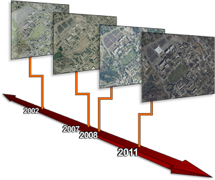
GIS Layers Timeline

Data published through this site may be used directly in GIS clients such as ArcGIS Desktop, or embedded in Web Mapping Applications via APIs such as ESRI's ArcGIS API for JavaScript.

To create a stored connection to this server that can be used in ArcMap, do the following:

  • In ArcCatalog, expand the catalog tree entry for "GIS Servers" and double-click "Add ArcGIS Server".
  • Select the radio button to "Use ArcGIS Services" and click Next.
  • Select the radio button for "Internet". Then
    • For the Server URL field, enter
      http://garden.gis.vt.edu/arcgis/services
    • Under "Authentication (optional)": Leave Username and Password blank.
    • Click "Finish".
  • You now should have a connection entry for this server in your catalog tree, with a name similar to "arcgis on garden.gis.vt.edu".
  • In ArcMap, you may now browse to this connection under the Catalog tree when you click the "Add Data" button, and then navigate to the services you wish to consume as basemap layers in your map.


For web mapping applications, use the REST endpoint instead. Each map service on this server is accessible via a URL of the form

http://garden.gis.vt.edu/arcgis/services/<folder name>/<service_name>/MapServer

Thus, the Web Mercator version of the MostRecentImagery service would be referenced as follows:

http://garden.gis.vt.edu/arcgis/rest/services/MostRecentImagery/MostRecentImagery_WGS/MapServer

As an example, if you were developing a web application using the ArcGIS API for JavaScript, you might add the above layer using the following reference:

var basemap = new esri.layers.ArcGISTiledMapServiceLayer("http://garden.gis.vt.edu/arcgis/rest/services/
MostRecentImagery/MostRecentImagery_WGS/MapServer
");
map.addLayer(basemap);

See http://resources.arcgis.com/content/arcgisserver/web-apis for more information on embedding published map services from this system into ArcGIS Web API applications.

Enterprise GIS
Andrews Information Systems Building
1700 Pratt Drive (0214)
Blacksburg, VA 24061

Email the EGIS
or call us at (540) 231-2178
© Virginia Polytechnic Institute and State University, EGIS, Privacy Statement
Designed by Program Webmaster
Virginia Tech GIS